 Éric Marty | @allopole
Shell Oil Spill - Gulf Of Mexico
 (Google Earth) Animated flight over Shell Oil Spill with photos (scroll down to download .kmz)
On May 12, 2016, an oil spill occurred in the Gulf of Mexico, originating in Royal Dutch Shell’s “Glider” Oil Field, at about 1000 m.
The leak, which according to Shell has been stopped, emanated from the infrastructure that ties the oilfield to its “Brutus” floating oil platform, about 10km (or 5 1/2 nautical miles) away.
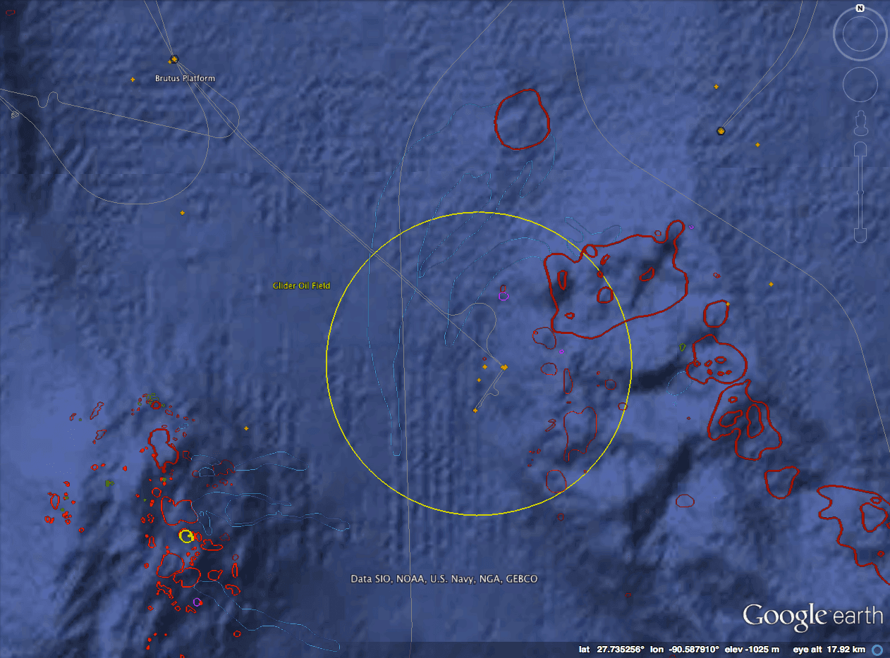 Map of the leak area. The leak originated somehwere in the Glider field, circled in yellow, which is connected via pipelines to the Brutus platform. Areas outlined in dark red are communities of chemosynthetic organisms associated with methane hydrates and natural oil and gas seepage. Orange crosses are wellheads on the seafloor. DATA: BOEM
According to Shell, about 88,000 gallons were realeased (compare to the 206 Million gallons released in the Deepwater Horizon accident).
Visual estimates suggest the spill could be much bigger than 88,000 gallons…
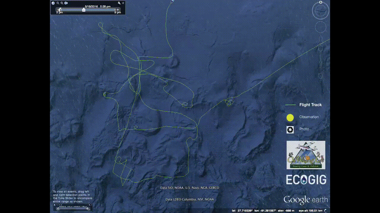
ECOGIG researchers have flown over the area twice, on 5/15 and 5/18, the second flight coordinated with ECOGIG researchers on board the R/V Tommy Munro.
Update: The flight reports and images from On Wings of Care (linked to here) are not available at the moment. It looks like On Wings of Care is in the process of transfering files to a new webserver. This inlcudes the images of the spill in the kmz file below.
In her 5/15 flight report, Dr. Bonny L. Schumaker (On Wings Of Care), flying with ECOGIG scientist Ian MacDonald, wrote:
“Even if the average thickness of the visible oil were a mere 100 micron (0.1 millimeter, vastly smaller than the areas of emulsified oil that stretch across the area), the visible surface oil would represent about 500,000 gallons of oil. We haven’t seen images like this since the BP disaster of 2010.” - source
That’s much less than DWH’s 206 Million gallons, but a lot more than Shell’s estimate of 88,000 gallons for this spill. Here’s an image of the spill from the air, with a skimming operation going on tin the upper left.

You can read the full flight reports, with LOTS of photos here and here
If you’d like to see where all these photos were taken, check out the 5/18 flight path and browse images in Google Earth:
OWOC20160518_hires.kmz - Download the .kmz file and open in Google Earth.